The state of Jammu & Kashmir consists of three parts: Jammu, which is essentially an extension of the Punjab and is full of Hindus and Sikhs; the Kashmir valley, best known for natural beauty, international jihadism, and Led Zeppelin songs; and Ladakh, which despite getting no love in the state's name actually comprises most of its territory. Ladakh is a vast, incredibly empty expanse of desert mountains and valleys on the far side of the Himalayas, wedged in between Hindu India, Tibet, and the Central Asian 'Stans. Most importantly, Ladakh is completely immune to the South Asian monsoon, which was heading towards the Kullu valley at an alarming pace for those of us without gills, so I booked a van up into the mountains with haste.
There are only two roads into all of Ladakh. One is a paved road up from the Kashmir valley that passes right by the Indo-Pak battle lines on the Line of Control, and the other is a notoriously rugged and remote road starting at the Rohtang La and going over the spine of the Himalayas, through hundreds of kilometers of nomad-populated mountain wilderness, and over high mountain passes including the world's second-highest stretch of road. Since I planned to visit Kashmir as well, the only question was which way around these two roads to go. Thinkly deeply on the question, I decided that if Lashkar-e-Toiba and their buddies in the Pakistani Taliban and paramilitary services decided to start lobbing artillery at the Kashmir-Ladakh road, as they do from time to time, it would be easier to dodge mortar fire running downhill. Thus did I embark on the epic, infamous slog from Manali to the Ladakhi capital of Leh.
The journey did not get off to a good start. My van was half an hour late in leaving. Admittedly, this was entirely my own fault, as I was standing right there watching the climactic overtime finish of the World Cup playoff between the USA and Ghana. I got on the bus, cranked with about a gallon of chai in my system, and instantly began to see the drawbacks of beginning journeys on chai-binges at 2:30AM when I had the mother of all sugar crashes as we wound our way up the godforsakenly long switchbacked road up the Rohtang La in the dead of night. [Oh, by the way, "La" means "pass", which I probably should have mentioned several posts ago].We stopped about halfway to the top, where we could see the lights of half the Kullu valley twinkling in the crisp night air. The mountainside was silent, save for the distant crashing of snowmelt waterfalls leaping off the cliffs, and the very close crashing of vomit waterfalls splashing around our shoes.
We reached the top of the Rohtang La in the wee-est hours, which is the way to do it, because unlike my previous passage the road was completely unblocked. There were no hordes of tourists trying to execute three-point turns over icy puddles in Suzuki town cars, no herds of ponies waiting for custom in the street, and no blindingly awful snowsuits threatening to distract the driver and plunge us all off a cliff. By the time we were halfway down the almost-as-interminable northern side of the mountain we were treated to a spectacular dawn view of the Lahaul valley, a sparsely settled, almost tree-less mountain valley that shimmers green with grasses clinging to the dark stone mountainsides and ice cream-like snow toppings dribbling down its peaks. This valley is defined by snowmelt. I assume that's what keeps the cliffsides green, and if you go two hundred yards without seeing a waterfall, it's only because a glacier is parking in the waterfall's spot. Unfortunately I missed most of the scenery in Lahaul because my chai-induced molecular decay had me slipping in and out of a half-sleep trance for the remainder of the morning.
At some point in the morning about seven hours after leaving Manali we stopped in the Lahauli capital of Keylong for breakfast and chai, of which I did not partake. Beyond Keylong is a whole lot of nothingness, marked by India's most famous highway sign, which announces that there will not be another petrol pump for 370 kilometers. As I faded into unconsciousness again we started the crawl up the second of the high passes on the journey, Baralacha La, which would take us over to the far side of the main range of the Himalayas. I woke up with a shiver as we got near the top. We were in a gigantic snow field, surrounded by nothing but dark pinnacles of rock capped in thick sheets of immaculate white snow. In case you haven't gotten the point, even at the end of June it was a memorably snowy place, and I have spent multiple winters in New England.
The fact that we had just crossed the Himalayas made little impression on us, as we were still not even halfway and the far side of the Himalayas actually consists of even more mountains and the road proceeds to get ever higher and rougher. Just after Baralacha La we crossed the state boundary into Jammu & Kashmir, but where we were exactly was an excellent question. If you look at Indian maps of the Himalayas, you will see that this area is somewhere in between Lahaul, Ladakh, and the ludicrously remote area of Zanskar, but none of the maps actually have any name for this area at all, and indeed depict nothing but a little red line twisting through a bunch of mountains. This is pretty much accurate. For hundreds of miles, there isn't so much as a village along this road. There are a handful of tent camps in the summer and two or three army stations along the way where understandably bored-looking soldiers tend to small medical posts and bulldozer maintenance shacks. Not even the Tibetan mountain peoples have seen fit to civilize this region. I have heard that some people call the area "Korzok" (a barbarian name if there ever was one), after the nomadic the region of the same name which is actually about a week's donkey ride away.
As the hours wore on and the afternoon stretched across the arid Trans-Himalayan wastelands with little other than the occasional nomad and his sheep to relieve the monotony, we all became extremely grateful that the Manali-Leh highway offers what is undoubtedly the most stunning, epic, and beautiful expanse of endlessly boring shit in the world. Once you've climbed over your twelfth pass and four-hundred-and-seventy-eighth switchback of the day, you begin to wish the dramatic vistas would just end for a second and you find yourself daydreaming about cloverleaf highway off-ramps with hundred-foot high signs for Denny's and Cracker Barrel beckoning in the distance.
Oh, I almost forgot to mention (it almost goes without saying) that for the vast bulk of its 474km length, the "highway" we are talking about consists of a single lane of dirt and rocks, punctuated by permafrost, ice puddles, and glacial streams running over the track. The only good thing you can say about the road itself is that it mostly manages to keep a reasonable margin of safety along deadly precipices. I have also excluded recounting a great deal of jovial quips and other bonhomie amongst the passengers of the van, because the circumstances warp one's perspective to find the utmost hilarity in remarks that are only the slightest bit relevant or amusing to people who are enduring the Manali-Leh bus together. Anyways, carrying on...
By the time we got to the third high pass, the 5000+ meter Lachulung La, the road had become almost Escher-like in its torturous geometry. It climbs up the side of valleys, through gorges, up serpentine slopes, and cuts into cliff-faces in such preposterous sequence that you half expect that getting back down the other side will require flooring the gas to clear a roller coaster style loop-de-loop carved into the hanging ice of a frozen waterfall. Sadly, there is no such contrivance, and you are merely forced to descend yet another freakshow of erosion, a veritable Barnum's circus of grotesque geological forces, to get to the other side.
The most terrifying part of the trip, paradoxically, is also the safest part. After many hours of alpine meandering you suddenly find yourself on a semi-paved, almost straight road running down the middle of a high-altitude valley called the More Plains. After 12 hours on some of the world's most painful roadway, the drivers can't resist gunning it and flying across the plains with reckless abandon, swerving dangerously to avoid stray boulders, broken culverts, and the odd herd of angora goats. On no account should you encourage the driver to slow down, or even ask for the day's 19th urine break, because THEY WANT TO MOVE GODDAMMIT, and when the same man is responsible for driving 19 hours straight over a dirt track that defies the laws of physics and human endurance, you should be prepared to indulge whatever keeps the driver at ease, even if it is allowing him to play teeny-bopper pop hits about first love on repeat. I'm not saying the choice is by any means a clear one, but the other option does happen to be death.
At long last, the road begins to gently rise on the side of the More Plains on its final ascent to the big boy itself, Taglang La. Taglang La, as every single person who has crossed it will gladly tell you, is the second-highest road pass in the world at some 5300 meters (17,000+ft.). When we reached the top just in time for a spectacular sunset, the sky streaked in dark hues of blue, purple, and grey.Below the wispy clouds far above in the atmosphere we had an uninterrupted view across the snow-capped peaks of the Zanskar mountains, the Ladakh mountains beyond that, and the saw-like profile of the mighty Karakoram on the horizon. I was gripped by the desire to whoop with joy, and even more gripped by the inability to do so because I felt like I was breathing from a helium balloon. The pass is at 5300 meters, whereas the unacclimated human body begins to suffer from altitude sickness at about 3500. Though I have spent much time in the mountains lately, I felt a slight shortness of breath, and strange dizziness with a rumbling headache and dryness of mouth that reminded me distinctly of many a Sunday morning recovering from the biochemical demands of a liberal arts education. My co-passengers, who were mostly on their very first venture up from the foothills, were not faring so well and were in various states of unconsciousness, misery, disorientation, high-energy experimental regurgitation, and conspicuous flatulence. *Sigh…*freshmen.
The remainder of the trip was made in the dark (again). We flashed down the northern side of the Taglang La in our van in much the same way that Donkey Kong and Indiana Jones traverse caves in a mining carts. Under the shroud of darkness we finally broke into the valley of the upper Indus river, the heart of Ladakh, and blindly passed by a number of fascinating things on our way to Leh...but the tales of those things are for another time. Just before midnight, when I was becoming finally convinced that my bladder, my pancreas, and at least one of my kidneys had been replaced by hacky sacks, we pulled into the bus lot at Leh. We were far too exhausted to take any stock of our surroundings, and splintered off to find just wherever the hell would let us sleep. I ended up in an alliance the van's token Indian passenger, a Hyderabadi named Sandeep (whose identity shall be concealed in this blog for his sake) and we ended up crashing in a Tibetan guesthouse.
I awoke the next day around noon. Sandeep would rise from sheer motionlessness and in complete misery at about six that evening, and by the time I returned at 8pm he had read the part of my guidebook that discussed a most interesting phenomenon he had never before heard of, but had certainly now experienced, called "Acute Mountain Sickness". Anyways, as I stepped out of the guesthouse that afternoon, I was more than a little curious to see the town I had gone to such lengths to reach, and what I saw...
...could only be described in the words in my next post. Laterz!

Picture Gallery
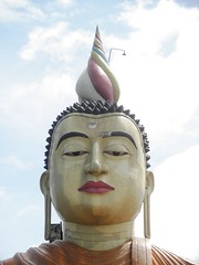
Ice Cream Mega Buddha
Updated 10/25:
Jaffna, Vallipuram, Kayts, Nainativu
Updated 10/8:
Maligawila, Kataragama, Tissamaharama, Wewerukannala, Mulkirigala, Unawatuna, Galle
Updated 9/27:
Trincomalee, Sri Pada (Adam's Peak), Horton Plains N.P., Haputale, Dambatenne (Lipton's Seat), Bambarakanda Falls, Ella

Subscribe


No comments:
Post a Comment
Commenting Rules:
1)No spam, viruses, porn etc.
2)DO NOT POST GF-B's REAL NAME
3)Remember this is a public website, don't provide sensitive info about yourself in the internet!